
Day 9
After finally picking up our visas at the consulate we start our journey .

We are still in Peru .

We will drive to Bolivia .

Enjoy the views.

And pass along the Titicaca lake.

Small towns along the way .

And poverty .

Finally we reach the border .

Looking back at Peru.

A new country :-)

The immigration office .

And we're off .

Still along Lake Titicaca .

The same look as Peru .

A unique building .

We are almost at our first destination .

Copacabana.

We're here for a boat ride .

Copacabana is the main Bolivian town on the shore of Lake Titicaca. The town has a large 16th-century shrine, the Basilica of Our Lady of Copacabana. Our Lady of Copacabana is the patron saint of Bolivia. The town is a destination for tourism in Bolivia. The town is also known for its famous Basilica, home of the Virgin of Copacabana, its trout, and its quaint atmosphere.

Built between Mount Calvario and Mount Niño Calvario, the town has approximately 6,000 inhabitants. Copacabana's religious celebrations, cultural patrimony, and traditional festivals are well known throughout Bolivia. Boats leave for Isla del Sol, the sacred Inca island from Copacabana.

Memories .

Time to set off.

Ruins on the hills .

And ancient terraces.

Now we're back on Titicaca but this time from Bolivia .

Cold .

And we reach .

Isla del Sol .

Or ''Sun island''

Isla del Sol (Island of the Sun) is an island in the southern part of Lake Titicaca. It is part of Bolivia, and specifically part of the La Paz Department. Geographically, the terrain is harsh; it is a rocky, hilly island with many eucalyptus trees. There are no motor vehicles or paved roads on the island.

The main economic activity of the approximately 800 families on the island is farming, with fishing and tourism augmenting the subsistence economy. Of the several villages, Yumani and Ch'allapampa are the largest.

There are over 80 ruins on the island. Most of these date to the Inca period circa the 15th century AD. Archaeologists have discovered evidence that people lived on the island as far back as the third millennium BC. Many hills on the island contain agricultural terraces, which adapt steep and rocky terrain to agriculture

What a view .


Ancient niches .

Still intact .

Places for statues ?

The town of Yunani.

We're here for this .
The Inca stairs .

See the water.
It comes from the Inca fountain at the top .

Now for my favorite activity

Climbing stairs.....not .

An Inca warrior .

And his lady .

Joy .

Drainage next to the stairs.

Still a ways to go .

Snow mountains in the background .

The chronicler Bernabé Cobo documented two versions of an Inca origin myth that took place on the northern part of this island. The first Inca Manco Cápac is said to have emerged from a prominent crag in a large sandstone outcrop known as Titi Qala. Manco Cápac is the son of Inti the Andean deity identified as the sun. In one version of the myth, the ancient people of the province were without light in the sky for many days and grew frightened of the darkness. Finally, the people saw the Sun emerge from the crag and believed it was the Sun's dwelling place.

In another version related by Cobo, others believed the crag was dedicated to the Sun because it hid under the crag during a great Flood. Isla del Sol was the first land that appeared after the flood waters began to recede and the Sun emerged from Titi Qala to illuminate the sky once again. A temple was built at this rock and later expanded by the 10th Inca Tupac Inca Yupanqui. He built a convent for mamaconas (chosen women) and a tambo (inn) for visiting pilgrims.

After that experience we head back to shore.....

Get in our car ...

...and continue our journey .

We are headed to La Paz .

A short cut here .

To cross by barge .

Sights in this small town .

Rickety :-)

Then its back on the road .

Check in , eat and zzzzzzzzz

Day 10
We leave La Paz early

To here.....Uyuni.

Wide open spaces .

Our ride awaits .

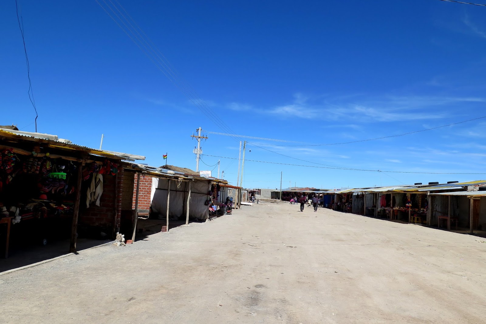
The main town .

Interesting to say the least .

I've seen 3rd world countries not as bad as this .

I really wonder what the government is doing .

Upkeep and maintenance is almost non existent .

Any way , we are just passing through .

The locals have to live here .

Locals .

First we visit here .

One of the major tourist attractions of the area is an antique train cemetery. It is located 3 km outside Uyuni and is connected to it by the old train tracks.

Nice views .

The town served in the past as a distribution hub for the trains carrying minerals on their way to the Pacific Ocean ports. The train lines were built by British engineers who arrived near the end of the 19th century and formed a sizable community in Uyuni.

The engineers were invited by British-sponsored Antofagasta and Bolivia Railway Companies, which is now Ferrocarril de Antofagasta a Bolivia. The rail construction started in 1888 and ended in 1892.

It was encouraged by the then Bolivian President Aniceto Arce, who believed Bolivia would flourish with a good transport system, but it was also constantly sabotaged by the local indigenous people who saw it as an intrusion into their lives

The sun is scorching due to the altitude .

The trains were mostly used by the mining companies. In the 1940s, the mining industry collapsed, partly due to the mineral depletion. Many trains were abandoned thereby producing the train cemetery.

A nice visit

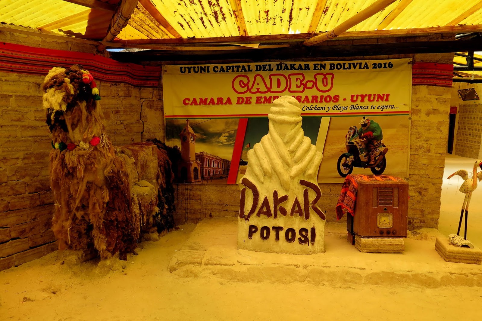
Dakar !!!

That's about 17K feet . Tunupa Volcano .

Now we head past town . To here .

Colchani is a tiny, one street town situated on the edge of the Tunupa Salt Flat, 80 km (50 miles) northwest of Uyuni, Bolivia.
The only salt-making facilities using salt from the Salar de Uyuni are located in Colchani – a cooperative joint-owned by all salt workers. There is an estimated 10 billion tonnes of salt contained in the Salar de Uyuni, with around 25,000 tonnes excavated and processed at Colchani annually.

The building walls are all made of salt .

And covered in mud .

A little museum with ''figurines''

Not very artistic though .

The salt theme continues .

A quick look...

And its time to move .

Now for the main attraction .

The salt flats .

The monument is to 13 people (5 Japanese and 5 Israeli tourists, plus 3 Bolivians) who were killed when their vehicles were involved in a head on collision on the Salar on 1st May, 2008

The recent rains were heavy...

So the water is a bit deep .

Salar de Uyuni (or Salar de Tunupa) is the world's largest salt flat, at 10,582 square kilometers (4,086 sq mi). It is in the Daniel Campos Province in Potosí in southwest Bolivia, near the crest of the Andes and is at an elevation of 3,656 meters (11,995 ft) above sea level.

The Salar was formed as a result of transformations between several prehistoric lakes. It is covered by a few meters of salt crust, which has an extraordinary flatness with the average elevation variations within one meter over the entire area of the Salar. The crust serves as a source of salt and covers a pool of brine, which is exceptionally rich in lithium.

It contains 50% to 70% of the world's known lithium reserves. The large area, clear skies, and exceptional flatness of the surface make the Salar an ideal object for calibrating the altimeters of Earth observation satellites.

Following rain, a thin layer of dead calm water transforms the flat into the world's largest mirror, 129 kilometres (80 miles) across.

The Salar serves as the major transport route across the Bolivian Altiplano and is a major breeding ground for several species of flamingos.

Salar de Uyuni is part of the Altiplano of Bolivia in South America. The Altiplano is a high plateau, which was formed during uplift of the Andes mountains. The plateau includes fresh and saltwater lakes as well as salt flats and is surrounded by mountains with no drainage outlets


The Salar is virtually devoid of any wildlife or vegetation.

Amazing mirrored effects .

We're still moving .

Each car will find its own patch .

Salt crystals .

Look at the views .

Amazing everywhere .

And in the distance .

A hotel .

And the Dakar monument .

Memories !!

What a rush .

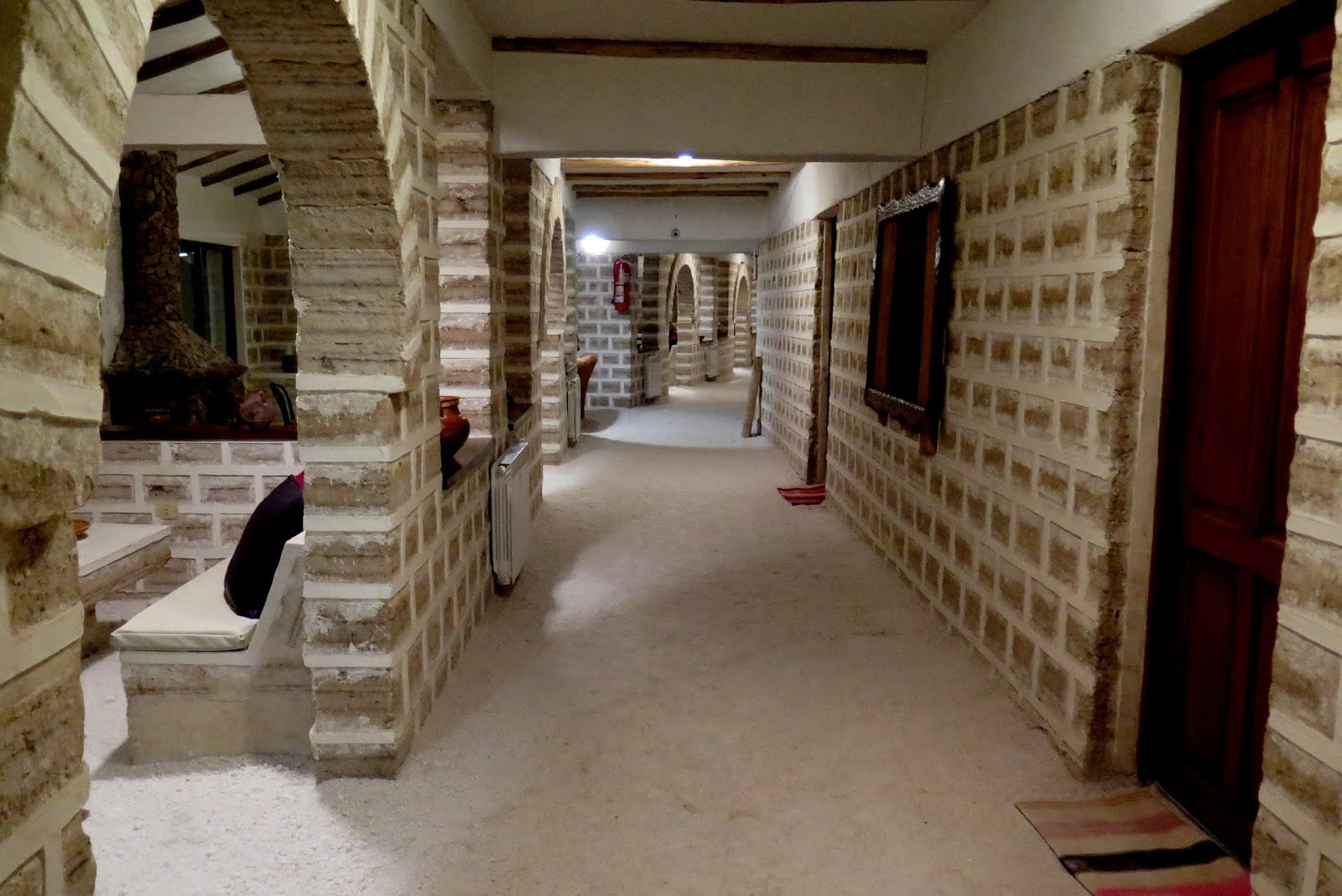
Palacio de Sal (Spanish for "Palace of salt") is a hotel built of salt blocks. It is located at the edge of Salar de Uyuni, the world's largest salt flat, 350 km (220 mi) south of the La Paz department's capital La Paz

Salt bunny :-)

Nice huh .

Visitors put their flags there .

The first hotel was built in 1993-1995 out of salt blocks in the middle of the Salar de Uyuni, and soon became a popular tourist destination. It had 12 double rooms, a common bathroom, and no shower.

Around 2007, a new hotel was built, under the name Palacio de Sal, in a new location at the eastern edge of Salar de Uyuni, 25 km away from the town of Uyuni. The site is 350 km (220 mi) south of Bolivia's capital La Paz.

The building was constructed of about 1 million 35-cm (14-inch) salt blocks, which are used for the floor, walls, ceiling and furniture, including beds, tables, chairs and sculptures.
In the new hotel, as in the old one, there is a rule prohibiting licking the walls (in order to prevent their degradation).
ha ha ha ha
Back on the road ?

We look for a nice spot.

Soon we find it .

Not too bad .

The boots are provided .

So we walk a bit .

And take madams pictures .

While the boys are at work.

Actually, so am i .

How cool is this . seriously .


We insisted on our crew joining us .

Then its back to entertaining madam .

On the way back we pass these guys who were stuck .

And we reach our hotel .

Made entirely of ?

Not too bad .

Nice common area .

The outside does not look like much .

But the room...

Is in top shape .

With a view of the salar .

Not bad . Wouldn't guess it from the outside .

After a nap...

We head back to the salt flats .

To watch the sunset .

Its bloody cold at night here .

Trying to be artistic .

Getting this sunset...

In the background .

Sunset here .

We will never forget this place .

Its amazing...

Beautiful...

...and special .

3606 m.

What a day .
Day 11
The next day we head back.

Nice hotel .


There was a road block by the indigenous locals .

And if u drive past they will throw dynamite.

So we had to walk a bit.

With luggage .

To the airport .

A short flight...

Past the salt flats...

And we reach La Paz .

An ancient truck .

The general trend of upkeep is the same in Peru and Bolivia.

Non existent .

We head out of the city .

City sights .

We are headed to an interesting place .

The country side is beautiful though .

And quite empty .

Finally we reach.

Thanks to ''Ancient Aliens''


That's a pyramid .


The Akapana is an approximately cross-shaped pyramidal structure that is 257 m wide, 197 m broad at its maximum, and 16.5 m tall. At its center appears to have been a sunken court

A staircase with sculptures is present on its western side. Possible residential complexes might have occupied both the northeast and southeast corners of this structure.

Originally, the Akapana was thought to have been developed from a modified hill. Twenty-first-century studies have shown that it is an entirely man made earthen mound, faced with a mixture of large and small stone blocks. The dirt comprising Akapana appears to have been excavated from the "moat" that surrounds the site.

The largest stone block within the Akapana, made of andesite, is estimated to weigh 65.70 metric tons

The Akapana East was built on the eastern side of early Tiwanaku. Later it was considered a boundary between the ceremonial center and the urban area. It was made of a thick, prepared floor of sand and clay, which supported a group of buildings.

Yellow and red clay were used in different areas for what seems like aesthetic purposes. It was swept clean of all domestic refuse, signaling its great importance to the culture.

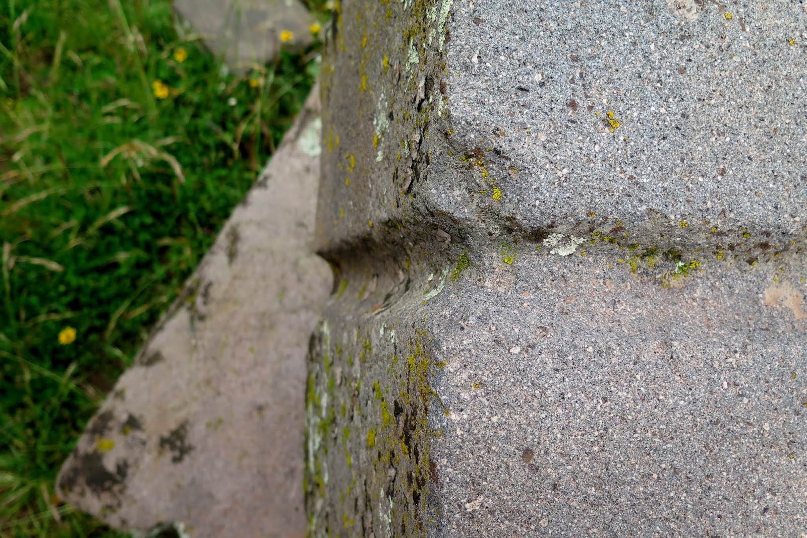
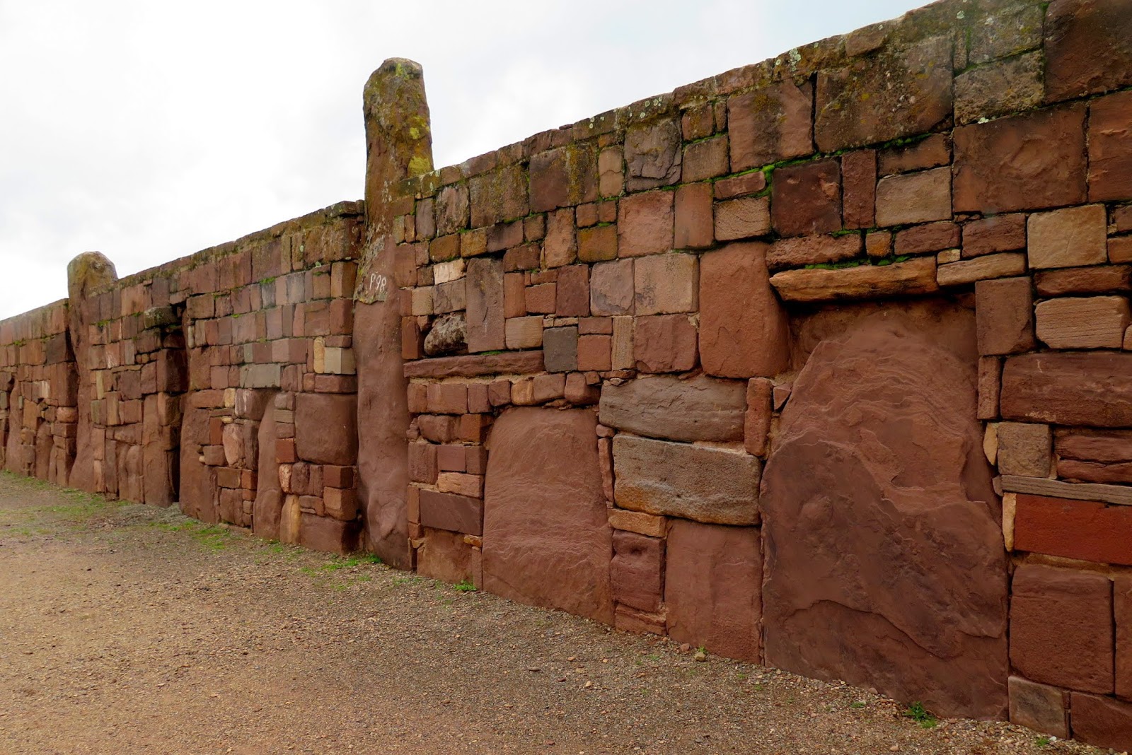
Amazing stone work.

The Pumapunku is a man-made platform built on an east–west axis like the Akapana. It is a rectangular, terraced earthen mound faced with megalithic blocks. It is 167.36 m wide along its north–south axis and 116.7 m broad along its east–west axis, and is 5 m tall. Identical 20-meter-wide projections extend 27.6 meters north and south from the northeast and southeast corners of the Pumapunku

Puma Punku's name means "The Door of the Puma". The Pumapunku complex consists of an unwalled western court, a central unwalled esplanade, a terraced platform mound that is faced with stone, and a walled eastern court.

Explain this.

Aliens !!!!!

Seriously .
And this !!


Also called the Palace of the Sarcophagus, by Arthur Posnansky, cause there he found burial chambers with a close resembling to a sarcophagus, made in blocks of andesite.

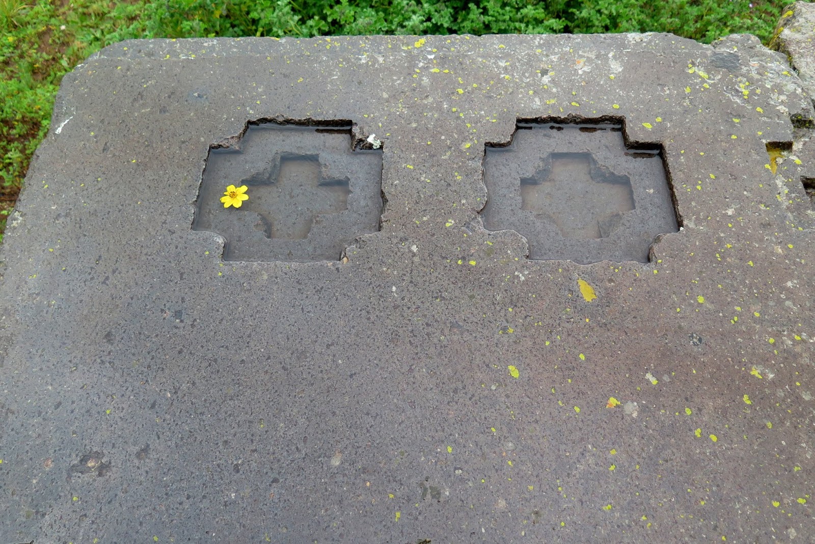
A prominent feature of the Pumapunku is a large stone terrace; it is 6.75 by 38.72 meters in dimension and paved with large stone blocks. It is called the "Plataforma Lítica". The Plataforma Lítica contains the largest stone block found in the Tiwanaku site.

According to Ponce Sangines, the block is estimated to weigh 131 metric tons. The second-largest stone block found within the Pumapunku is estimated to be 85 metric tons .

The Kalasasaya is a large courtyard more than 300 feet long, outlined by a high gateway. It is located to the north of the Akapana and west of the Semi-Subterranean Temple.

Within many of the site's structures are impressive gateways; the ones of monumental scale are placed on artificial mounds, platforms, or sunken courts. Many gateways show iconography of the Staff God.


The Gate of the Sun is a megalithic solid stone arch or gateway constructed by the ancient Tiwanaku culture of Bolivia.

The Staff God is a major deity in Andean cultures. Usually pictured holding a staff in each hand, with fanged teeth and splayed and clawed feet, his other characteristics are unknown, although he is often pictured with snakes in his headdress or clothes. He is known as Viracocha in the Incan religion.

The object is approximately 9.8 ft (3.0 m) tall and 13 ft (4.0 m) wide, and is constructed from a single piece of stone. The weight is estimated to be 10 tons.

Niches for offerings at the back .

Then we have this .

Easter island anyone ?


There is more further down .

The same Hat as the Easter island statues .


We keep moving .

Through a light rain .

Nothing like Asian rain .

Many theories for the skill of Tiwanaku's architectural construction have been proposed. One is that they used a luk’a, which is a standard measurement of about sixty centimeters
The elites of Tiwanaku lived inside four walls that were surrounded by a moat. This moat, some believe, was to create the image of a sacred island. Inside the walls were many images devoted to human origin, which only the elites would see. Commoners may have entered this structure only for ceremonial purposes, since it was home to the holiest of shrines

Its huge .

More statues .

A bit eroded .

The Kalasasaya is a low platform mound with a large courtyard, which is surrounded by high stone walls. The Kalasasaya is about 120 by 130 meters in dimension and aligned to the cardinal directions. Like the other platform mounds within Tiwanaku, it has a central sunken court.

The Kalasasaya dates to at least 200 BCE - 200 CE.

This sunken court can be reached by a monumental staircase through an opening in its eastern wall. The walls are composed of sandstone pillars that alternated with sections of smaller blocks of Ashlar masonry and incorporates tenon heads of many different styles.

The statue of Viracocha .

And across the stairs is the sunken courtyard.

With many heads embedded in the walls .

The walls are composed of sandstone pillars that alternated with sections of smaller blocks of Ashlar masonry and incorporates tenon heads of many different styles.

And the central statues .

Whats interesting here is.....

That head in white.

Familiar ?

Quite an interesting place .

The effect of ages .

Memories .

We continue on our way .

To another site.

A last look .

How is this done to solid rock .

Hand tools . Really ???

This is the beauty of travel .

Not stupid selfies .

It opens your eyes and mind .

We keep walking...

Looking and wondering .

A last look at the sun gate .

No rain now .

Then its time for lunch .

This smart guy made his restaurant look like the ruins .

This right here is my ultimate dream .

In the museum next to the site photos are not allowed....but
I just had to take these.

Very interesting .

Stealth photography ,from the Sistine chapel to Peru .

This statue is huge.
Pachamama statue.
Pachamama is a goddess revered by the indigenous people of the Andes. She is also known as the earth/time mother. In Inca mythology, Pachamama is a fertility goddess who presides over planting and harvesting, embodies the mountains, and causes earthquakes.

And finally we visit here .

We saw these stones first on Ancient Aliens .

And were blown away .

Its amazing to look at this ,and wonder how its done .

Multi level precision cuts .

In a huge plain .

The weather is a bit bad but still an experience .

That huge stone is interesting...more later .

These look to be interlocking stones .

The large stones from earlier have similar glyphs that are seen at Nazca .

We will never know will we .

This is truly amazing .

After that experience we head to La Paz .

Traffic wardens....really .

Quite similar to Peru .

Sights of the city .

And their traditional outfits .

After a long day ,its time to rest .
Day 12
The next day we take an early flight from La Paz to Lima .

And the last part of our trip .

We tour the city of Lima . Starting with the Miraflores and San Isidro areas .

And the central plaza .

The typical Spanish architecture .

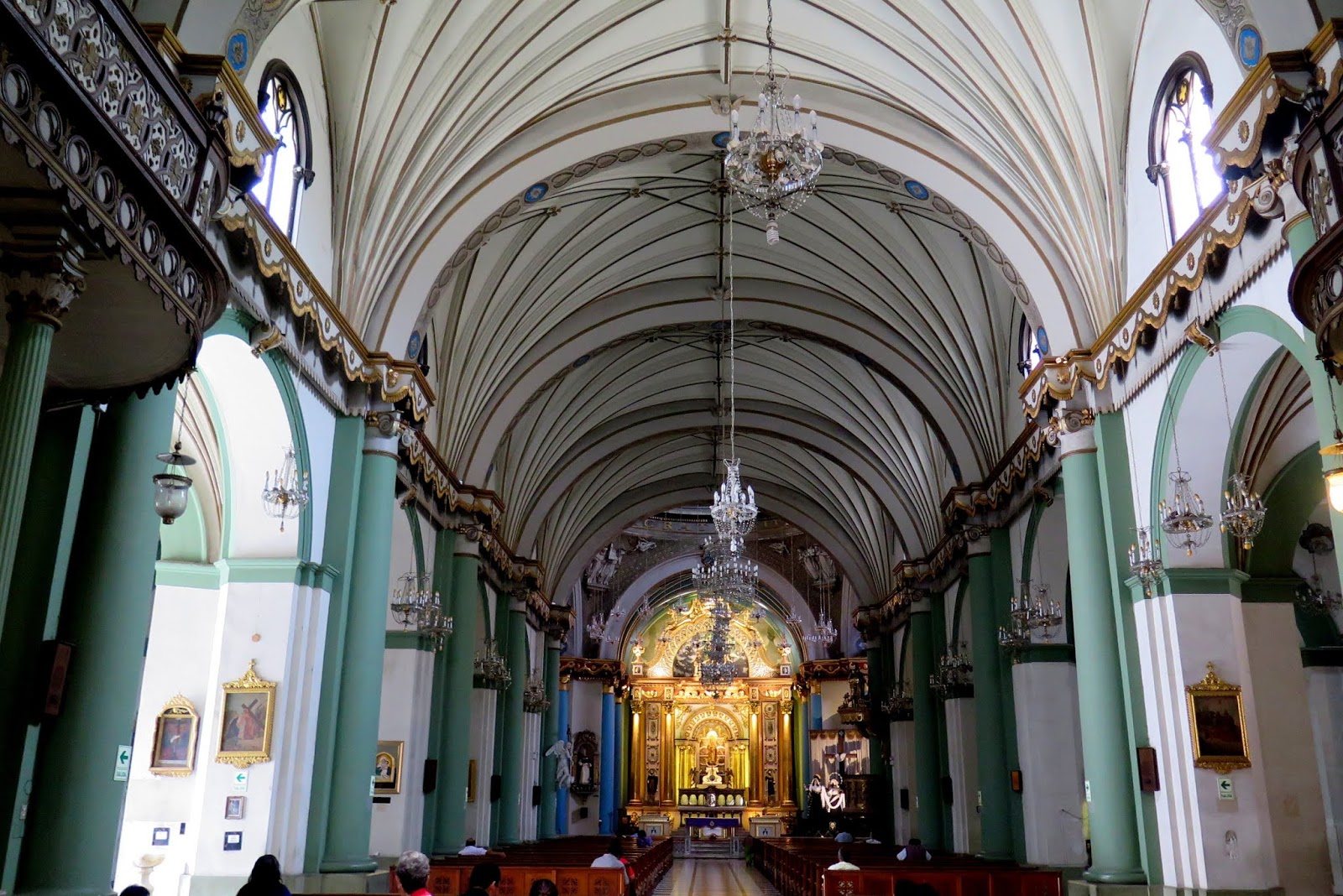
And the Cathedral .

So we go in ...

A very nice design .

The main altar .

That statue makes me think of Zeus...no ?

The crypts below the floor...

And next to the cathedral are the grounds of the monastery .

We leave and walk around the main square .

What is really interesting is all the building we built over existing Incan temples .

All of this .

The central attraction .


The Municipality

Peru...... it has been quite a trip .

That caught my eye .

An old school water cannon .

Nice streets to walk and be seen.

This is the original plan of this place .
Is it me or do these look like Ziggurats .

We then visit here .

Convent of Santo Domingo
The Minor Basilica and Maximus Convent of Nuestra Senora del Rosario, popularly known as that of Santo Domingo, located in the city of Lima, Lima Region, capital of Peru, it's an architectural set of religious buildings under the invocation to Our Lady of the Rosary.

The historic chapter house of the Basilica of Santo Domingo was the place where the University of San Marcos, officially the first Peruvian university and the oldest university in the Americas, began to function in the 16th century.

Look at the detail...

The adjacent Cloister .

Composed of four galleries, decorated with Sevillian azulejos dating from 1604 and 1606;] the paintings that present passages of the life of Saint Dominic, founder of the Dominican order, were contracted in 1608 by the provincial superior of the Order of Saint Dominic in Peru with the Sevillians Miguel Güelles, disciple of Juan de Uceda and his collaborator, Domingo Carro

At every corner of this cloister there is a reredos with biblical representations. The roofs of these galleries are of oak from Panama, carved in Mudéjar style; also stands out in this cloister the presence of a bronze home stoup, ordered to be built by the Dominicans.

Decorated everywhere .

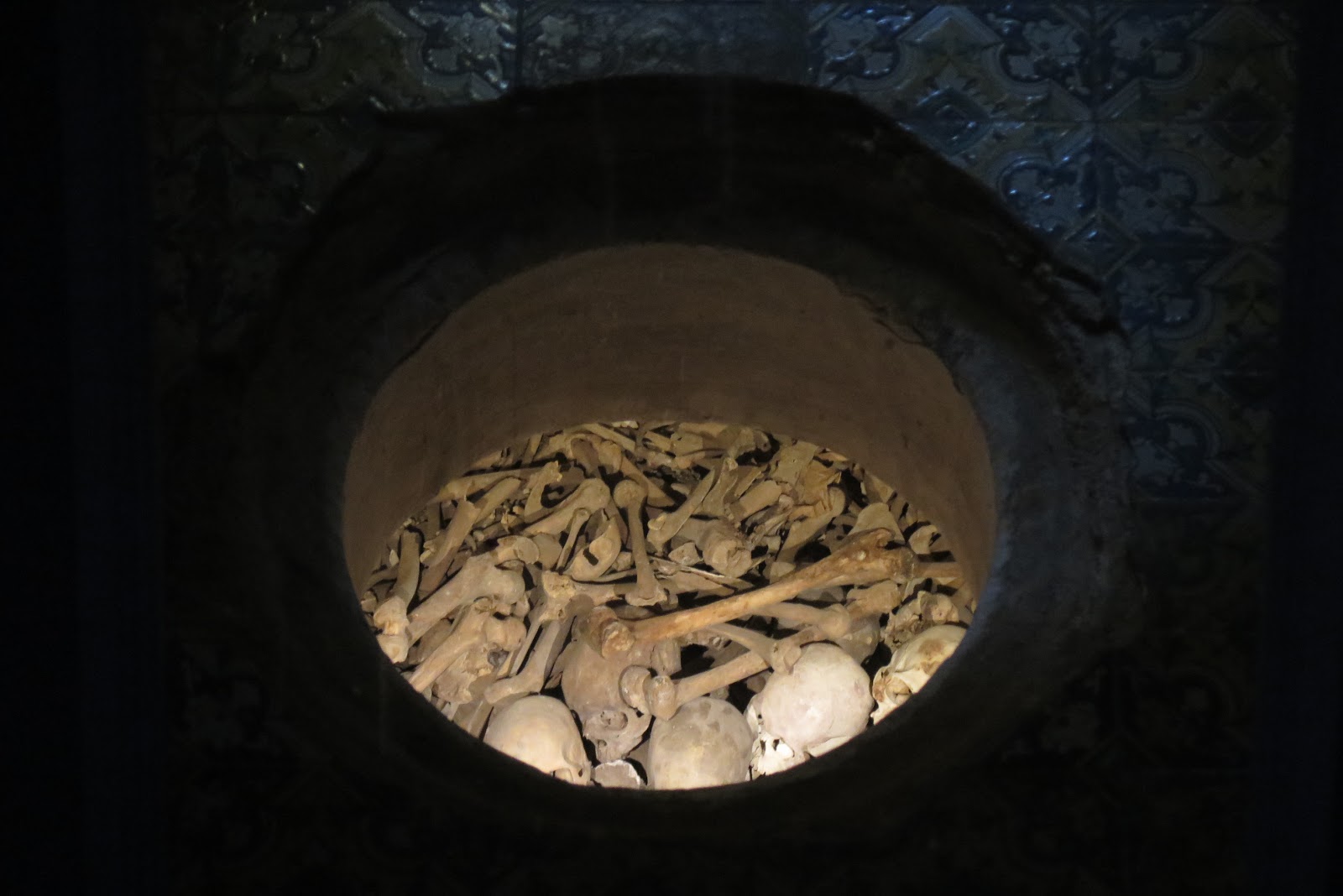
Located in the place that was an old cemetery where the first religious of the order were buried. An ossuary of several meters of depth where the bones of the time were placed. The tomb of marble where the remains of St. Rose of Lima are buried, are in the center of the environment that is decorated with mosaics.

The site for the crypt .

On a memorial plaque it reads: "Hago donación de mi cuerpo a mis hermanos Dominicos" (I make a donation of my body to my Dominican brothers). This phrase explains the gratitude of having belonged to the Tertiary Dominican Order.

More courtyards...

And a beautiful marble statue.

Tomb of Santa Rosa de Lima

We continue our journey...

And lastly visit the library.

One of the most worthy places to visit is the library, not only for the value of the writing works, but also for the coffered ceilings. In its power are the oldest books that the Dominicans used, being among these, incunables. The Library of the Convent has around 25,000 books, among them several bibliographical collections of great value.

A last look, then we leave...

Downtown Lima.

For the last part of our journey ,we stop here.
Huaca Pucllana or Huaca Juliana (possibly from Quechua wak'a a local shrine to a protector deity, a sacred place, sacred, pukllana game) is a great adobe and clay pyramid located in the Miraflores district of central Lima, Peru, built from seven staggered platforms. It served as an important ceremonial and administrative center for the advancement of the Lima Culture, a society which developed in the Peruvian Central Coast between the years of 200 AD and 700 AD.

What a way to end our trip.

This has been the furthest we have ever been.
Peru and Bolivia were amazing.
The people were nice and the history and natural beauty were fantastic.
There is only one life.
Live it to the fullest.
More to come.
Cheers .
No comments:
Post a Comment